As a unique soil mapping system consistently gains popularity across Canada, a new researcher at Dal’s Faculty of Agriculture is thrilled to be able to bring his expertise on the subject to Atlantic Canada.
With the ever-growing need to better understand the world’s soil resources, the field of digital soil mapping (DSM) is rapidly growing. Brandon Heung, an assistant professor in geospatial informatics, primarily focuses his research on digital soil mapping and is excited for the field to become more widely recognized across Canada.
“Although the field of digital soil mapping has been very active around the world over the last 25 years or so, it has really started to emerge in Canada over the last 10 years,” Dr. Heung explains. “I think that there are many opportunities to do digital soil mapping research in Canada and the upcoming years are going to be very exciting.”
A soil map is a geographical representation of soil types and properties, such as textures, organic matter, and depths of horizons. There are a number of uses but soil maps are used largely by farmers, land users and policy makers. Digital soil mapping is essentially a method of creating soil maps using a number of computerized methods to better understand the characteristics and variability of soils.
Continue reading at Dalhousie University.
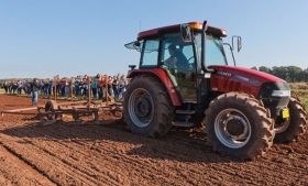
Image via Dalhousie University.


