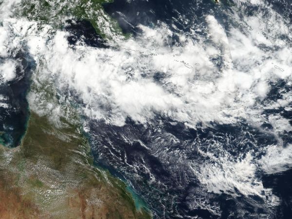
Former Tropical Cyclone Iris continues to linger in the Southwestern Pacific Ocean off the coast of Queensland, Australia. NASA-NOAA's Suomi NPP satellite passed over the remnants of Iris on April 10.
On April 10 at 0230 UTC (April 9 at 10:30 p.m. EDT) the Visible Infrared Imaging Radiometer Suite (VIIRS) instrument aboard NASA-NOAA's Suomi NPP satellite captured a true-color image of Iris' remnants. The VIIRS image showed a large, elongated low pressure area. That's because Iris' remnants were experiencing moderate to high vertical winds shear, as strong as 25 knots (28.7 mph/46.3 kph).
Animated multispectral satellite imagery showed scattered convection directly over a defined but broad low-level center.
At 1500 UTC (11 a.m. EDT) Iris' remnants were located near 12.7 degrees south latitude and 153.5 degrees east longitude. That's approximately 513 nautical miles east-northeast of Cairns, Australia. The Joint Typhoon Warning Center or JTWC noted "Some global computer forecast models predict the remnant low pressure area turning southwestward and re-developing into a tropical cyclone in the next several days, though not all maintain the circulation." Maximum sustained surface winds are estimated at 20 to 25 knots (23 to 28.7 mph/37 to 46.3 kph).
Read more at NASA/Goddard Space Flight Center
Image: On April 10 the VIIRS instrument aboard NASA-NOAA's Suomi NPP satellite captured a true-color image of Iris' elongated remnants in the South Pacific Ocean. (Credit: NOAA/NASA Goddard Rapid Response Team)