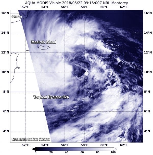
Tropical Cyclone 02A formed about 655 nautical miles south of Masirah Island, Oman. When NASA's Aqua satellite passed over the Arabian Sea, Northern Indian Ocean and captured a visible image of the newly developed storm.
The Joint Typhoon Warning Center or JTWC noted on May 22 at 5 a.m. EDT (0900 UTC) that 02A's center was located near 9.3 degrees north latitude and 57.2 degrees east longitude. Tropical Cyclone 02A was moving to the north at 5.7 mph (5 knots/9.2 kph). Maximum sustained surface winds were estimated at 40 mph (35 knots/62 kph).
The Moderate Resolution Imaging Spectroradiometer or MODIS instrument that flies aboard NASA's Aqua satellite captured a visible image of 02A. The image showed that convection continues to consolidate and organize around the low level center, with the strongest storms west of the center.
Read more at NASA / Goddard Space Flight Center
Image: On May 22 at 5:15 a.m. EDT (0915 UTC), NASA's Aqua satellite captured a visible image of Tropical Cyclone 02A about 650 miles south of Masirah Island, Oman. The image strong thunderstorms around the center of circulation and in a band from north to northwest of the center. CREDITS: NASA / NRL