Tropical Depression 05W briefly reached tropical storm status overnight on June 5 into June 6, and then weakened back to a depression at 5 a.m. EDT (0900 UTC). Once 05W reached tropical storm status it was named “Ewiniar.” NASA’s Aqua satellite captured infrared imagery that provided clues that the storm would strengthen.
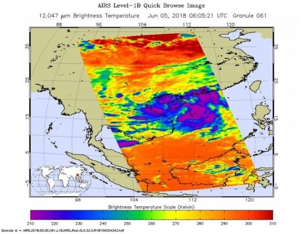
NASA's Aqua satellite passed over 05W on June 5 at 2:05 a.m. EDT (0605 UTC) and analyzed the storm in infrared light. Infrared light provides temperature data and that's important when trying to understand how strong storms can be. The higher the cloud tops, the colder and the stronger they are.
AIRS data showed coldest cloud top temperatures in thunderstorms flaring east of 05W’s center were warming, indicating weakening. Coldest temperatures were as cold as minus 63 degrees Fahrenheit (minus 53 degrees Celsius). Storms with cloud top temperatures that cold have the capability to produce heavy rainfall.
Ewiniar never made landfall on Hainan Island, China as its center stayed just to the east of the island. The storm did make landfall in extreme southwestern Guangdong province. The Joint Typhoon Warning Center or JTWC noted that a clear low level circulation center remains present over the southern portion of the Leizhuo Peninsula.
Read more at NASA/Goddard Space Flight Center
Image: NASA's Aqua satellite passed over Tropical Depression 05W on June 5 and saw coldest cloud top temperatures (purple) around the storm's center. (Credit: NASA JPL/Heidar Thrastarson)