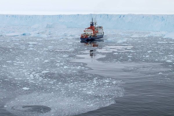
The Pine Island Glacier in Western Antarctica is not only one of the fastest-flowing ice streams in the Southern Hemisphere; over the past eleven years, four major icebergs have calved from its floating tongue. In February 2017, researchers on board the German research icebreaker Polarstern successfully mapped an area of seafloor previously covered by shelf ice. A comparison of these new maps with satellite images of the ice stream reveals why the glacier suddenly retreated toward the coast: at important points, it had lost contact with the ground, as the experts report in the online journal The Cryosphere, a journal of the European Geosciences Union.
With a flow speed of four kilometres per year, Western Antarctica’s Pine Island Glacier is one of the fastest-flowing ice streams in the Southern Hemisphere. Together with its neighbouring glaciers, every year the up to 50-kilometre-wide ice stream transports more than 300 gigatonnes of ice from the hinterland to the Amundsen Sea, and is responsible for between five and ten percent of the global sea-level rise. Scientists have already identified the cause of this rapid loss of ice: since the 1940s, warm water masses, which branch off from the Antarctic Circumpolar Current, have found their way beneath the floating part of the glacier, melting what is referred to as its ice shelf from below. As a result, the ice tongue, which is currently ca. 55 kilometres long, has been losing roughly 5.3 metres of thickness per year for the past quarter-century.
That being said, what remained unclear was why, despite this sustained melting, the Pine Island Glacier’s calving front had barely retreated since the beginning of observation in 1947. Then in 2015, a calving event shifted the edge of the ice shelf 20 kilometres nearer the coast and reduced the floating ice tongue’s total area to roughly 470 square kilometres.
Read more at Alfred Wegener Institute, Helmholtz Centre for Polar and Marine Research
Image: Polarstern at Pine Island Glacier (Credit: Thomas Ronge)


