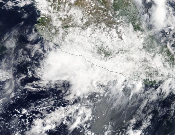
NASA Terra satellite captured an image of Tropical Depression Carlotta as it was making landfall in southwestern Mexico where it weakened into a remnant low pressure area.
On June 18, the MODIS or Moderate Resolution Imaging Spectroradiometer instrument aboard NASA's Aqua satellite captured a visible light image of the storm.
At 11 p.m. EDT on June 18 (0300 UTC on June 19), the National Hurricane Center (NHC) noted that Carlotta degenerated into a remnant low pressure area but was still producing heavy rainfall over southwestern Mexico. NHC issued the final advisory on Carlotta at that time, when it was centered near latitude 18.2 degrees north and longitude 103.6 degrees west. That was about 95 miles (150 km) west of Lazaro Cardenas, Mexico. Maximum sustained winds had decreased to near 25 mph (35 kph) with higher gusts. At that time, the post-tropical cyclone was crawling toward the northwest near 3 mph (6 kph).
Read more at NASA / Goddard Space Flight Center
Image: On June 18, the MODIS or Moderate Resolution Imaging Spectroradiometer instrument aboard NASA's Terra satellite captured a visible light image of Tropical Depression Carlotta over southwestern Mexico. CREDITS: NASA


