NOAA’s two primary short-range weather models received upgrades developed by NOAA researchers that will provide more accurate hazardous weather and aviation forecasts as they roll into operations (July 12) for the National Weather Service’s Storm Prediction Center, other national forecast centers and local forecast offices across the country.
The hourly-updating High-Resolution Rapid Refresh model (HRRR) and its “parent” model, the Rapid Refresh model (RAP), work hand-in-hand to provide the foundation for many of the forecast products issued by the NWS every day. The biggest changes came to the HRRR, NOAA’s 3-kilometer resolution storm-resolving model, which will provide more accurate predictions of thunderstorms and flooding potential more than a day in advance. The forecast area also has been expanded to include Alaska, where the primary mode of transportation is aircraft, and predictions of small-scale details on clouds, visibility, and icing are vital for pilot safety.
“The HRRR not only offers more accurate and more detailed weather forecasts,” said Paul Schlatter, the Science and Operations Officer for the National Weather Service’s Denver-Boulder forecast office. ”It’s turning out to be highly flexible to develop valuable forecast applications.”
The RAP and HRRR were conceived and developed by NOAA’s Global Systems Division, the weather-forecasting R&D arm of the Earth System Research Laboratory in Boulder, Colorado. NOAA’s National Centers for Environmental Prediction (NCEP), including the Environmental Modeling Center and NCEP Central Operations, worked closely with GSD to evaluate and implement the model into real-time operations. An experimental version of the HRRR, dubbed HRRRx, is run continuously at GSD to demonstrate, in real time, scientific advances before they are implemented into the NOAA operational model. The next set of GSD upgrades to the RAP and HRRR are due in 2019.
Continue reading at NOAA.
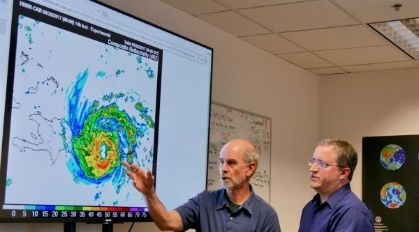
Image via NOAA.


