Tropical Depression 12W formed in the Philippine Sea and NASA-NOAA’s Suomi NPP satellite analyzed the storm in infrared light. The depression strengthened into Tropical Storm Ampil later on July 18.
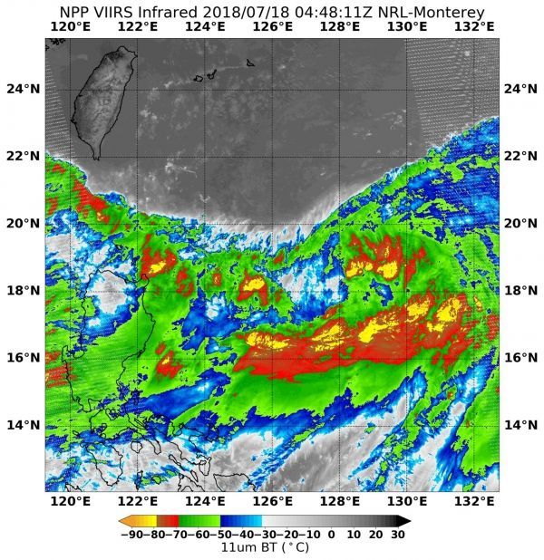
On July 18 at 12:48 a.m. EDT (0448 UTC) when the Visible Infrared Imaging Radiometer Suite (VIIRS) instrument aboard NASA-NOAA's Suomi NPP satellite captured an infrared image of the system it was still a depression. In the VIIRS image, Tropical Depression 12W appeared elongated, and contained some very cold cloud top temperatures near minus 80 degrees Fahrenheit (minus 62.2 degrees Celsius). NASA research has shown that storms where cloud tops are that could extend high into the troposphere and can generate heavy rainfall.
Read more at NASA / Goddard Space Flight Center
Image: On July 19, NASA-NOAA's Suomi NPP satellite captured an infrared image of newly formed Tropical Storm Ampil in the Philippine Sea. Red and yellow colors indicate coldest temperatures and strongest storms. CREDITS: NASA / NOAA / NRL