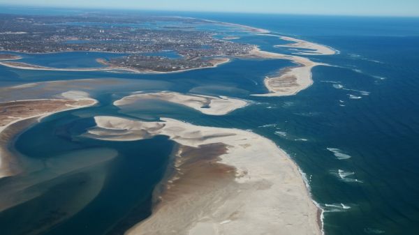
A first-of-its-kind survey of the world’s sandy shorelines with satellite data found that they have increased slightly on a global scale over the past three decades but decreased in protected marine areas, where many beaches are eroding.
Erosion in protected marine areas could threaten plant and animal species and cultural heritage sites. Worldwide, the study found that 24 percent of Earth’s sandy beaches are eroding, a coastline distance of almost 50,000 miles.
The view from space provided researchers with a more accurate picture of just how much of Earth’s shorelines are beaches. They found that about a third (31 percent) of all ice-free shorelines are sandy or gravelly. Africa has the highest proportion of sandy beaches (66 percent) and Europe has the lowest (22 percent).
Satellite image processing: Wave of the future
A team of scientists and engineers from the Netherlands used machine learning to “teach” their classification software to accurately identify sandy beaches from images taken by Landsat satellites from NASA and the U.S. Geological Survey. This allowed them to quickly and automatically examine 30 years of data and determine how many of Earth’s beaches are sandy instead of rocky or icy, and how those sandy beaches are changing with time.
Read more at NASA / Goddard Space Flight Center
Image: Cape Cod National Seashore is a protected marine area, home to a variety of ecosystems with diverse plants and animals. CREDITS: NASA Earth Observatory / Spencer Kennard


