Tropical Storm Jongdari appeared much more organized in visible imagery from NASA’s Terra satellite when passed over the Northwestern Pacific Ocean.
Tropical Depression 15W strengthened into a tropical storm on July 24 at 5 p.m. EDT (2100 UTC) and was renamed “Jongdari.”
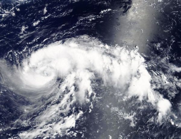
On July 25, the Moderate Resolution Imaging Spectroradiometer or MODIS instrument aboard NASA’s Terra satellite obtained a visible image of Tropical Storm Jongdari. The storm appeared more organized with bands of thunderstorms wrapping into the center, and a thick band northeast of the center. Infrared satellite imagery also showed a consolidating system with deep convective banding wrapping into a defined low-level circulation center. Microwave imagery has already revealed an eye feature.
Read more at NASA/Goddard Space Flight Center
Image: NASA's Terra satellite provided a visible look at Tropical Storm Jongdari in the Northwestern Pacific Ocean on July 25. The storm appeared more organized with bands of thunderstorms wrapping into the center, and a thick band northeast of the center. (Credit: NASA)