Tropical Depression 16W formed in the northwestern Pacific Ocean despite vertical wind shear. Wind shear was elongating the newly formed tropical depression when NASA's Terra satellite passed overhead and analyzed the storm in infrared light.
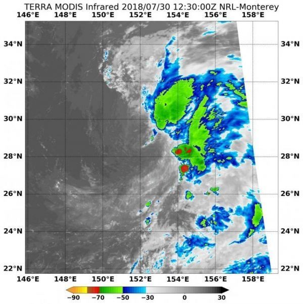
On July 30, the Moderate Resolution Imaging Spectroradiometer or MODIS instrument that flies aboard NASA's Terra satellite provided an infrared image of Tropical Depression 16W. 16W appeared elongated and fragmented because of westerly vertical wind shear. Two small areas showed thunderstorms with cloud tops colder than minus 70 degrees Fahrenheit (minus 56.6 degrees Celsius), and NASA research has shown that cloud tops that cold have the capability to produce heavy rainfall.
The Joint Typhoon Warning Center noted "Infrared satellite imagery depicts a partially-exposed, broad low-level circulation center with deep convection displaced over the eastern semicircle due to moderate to strong (20 to 30 knots/23 to 34.5 mph/37 to 55.5 kph) west-southwesterly vertical wind shear.
Read more at NASA/Goddard Space Flight Center
Image: On July 30, NASA's Terra satellite provided an infrared image of an elongated Tropical Depression 16W. Wind shear was pushing most of the storms east of the center. (Credit: NASA/NRL)