Visualize the following: The Earth’s climate swings between cold glacial and warm interglacial periods; the last glacial interval was about 20,000 years ago; sea level was about 126 meters (413 feet) below modern sea level at that time; and the Holocene, which represents the last 12,000 years of climatic change, is an interglacial period.
The last interglacial period about 127,000 to 116,000 years ago was the last time sea level was as high as or even higher than present-day sea-level. Understanding sea level change during the last interglacial period, a time when the earth was slightly warmer the present, is an important research area for understanding future sea level rise due to global warming.
The magnitude and trajectory of sea-level change during the Last Interglacial, more specifically Marine Isotope Stage (MIS) 5e, is uncertain. To date the consensus view has been that sea-level may have been six to nine meters above present sea level, values that require additional melting of Greenland and the West Antarctic ice sheet and that there were one or more oscillations of up to several meters superimposed.
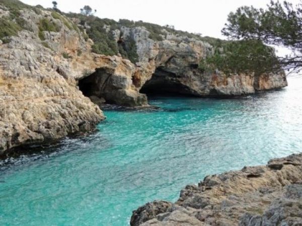
However, scientists at The University of New Mexico (UNM) and the University of South Florida (USF) and their international team of collaborators aren’t so sure that those sea level fluctuations are accurate. According to new research published today in the journal Nature Geoscience titled, A highly resolved record of relative sea-level in the western Mediterranean Sea during the Last Interglacial period, these scientists present a well-dated relative sea level record from the island of Mallorca in the western Mediterranean Sea for MIS-5e based on the occurrence of phreatic overgrowths on speleothems forming near sea level.
Read more at University of New Mexico
Image: The cave entrance from the Island of Mallorca in the western Mediterranean Sea. (Credit: Victor Polyak, UNM)


