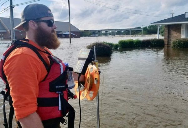
At least 80 U.S. Geological Survey scientists are in the field in the Carolinas and Virginia, working to ensure that vital information about river flooding continues to reach emergency managers, forecasters and others threatened by the catastrophic flooding that has been linked to 32 deaths.
Major flooding is underway Tuesday on several North and South Carolina rivers, including the Cape Fear, Northeast Cape Fear, Lumber, Waccamaw, PeeDee and Little PeeDee. While a few rivers on the Carolinas’ coastal plain reached their peak levels and began declining Monday, other rivers are still rising on the Carolinas’ coastal plain, and some may not peak until next week, said hydrologist John Shelton of the USGS South Atlantic Water Science Center.
USGS crews are evaluating many peaks of record, or instances when river and streamgages recorded the highest levels ever measured at those locations. At 14 streamgages the water levels were so high they are estimated to have only a one-in-500 probability of occurring in any given year. Two streamgages reached heights that have only a one-in-200 probability of occurring in a given year, and one recorded a one-in-100 probability peak.
The historic flooding that affects the entire state of North Carolina and eastern South Carolina is the result of the storm once known as Hurricane Florence, which dumped 36 inches of rain in the towns of Elizabeth and Swansboro, North Carolina. The storm moved westward into the Appalachian foothills and then took a northward turn, triggering tornadoes in Virginia late Monday. On Tuesday the remnant of a tropical cyclone was causing moderate flooding in portions of southern New York, and threatening to bring heavy rains to southern New England.
Continue reading at USGS.
Image via USGS.


