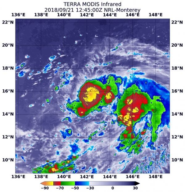
NASA’s Terra satellite provided an infrared look at Tropical Storm Trami, located just over 100 miles from Guam on Sept. 21. Infrared data provides temperature information that showed two areas of the highest, coldest cloud tops and most powerful storms within the tropical storm.
NOAA’s National Weather Service (NWS) in Tiyan, Guam said that a flash flood watch is in effect for all of Guam and the northern Marianas. A small craft advisory remains in effect until 6 a.m. CHST local time on Sunday, Sept. 23.
However, the Tropical Storm Watch for Rota, Tinian and Saipan has been canceled. Because Tropical Storm Trami (28W) continues to move away from the Marianas the threat of damaging winds has ended.
Read more at NASA / Goddard Space Flight Center
Image: At 8:45 a.m. EDT (1245 UTC) on Sept.21 the MODIS instrument aboard NASA’s Terra satellite looked at Tropical Storm Trami (28W) in infrared light. MODIS found coldest cloud top temperatures in two large areas, as cold as or colder than minus 80 degrees (yellow) Fahrenheit (minus 112 degrees Celsius). Surrounding them were powerful storms with cloud tops as cold as or colder than minus 70 degrees (red) Fahrenheit (minus 56.6 degrees Celsius). CREDIT: NASA / NRL