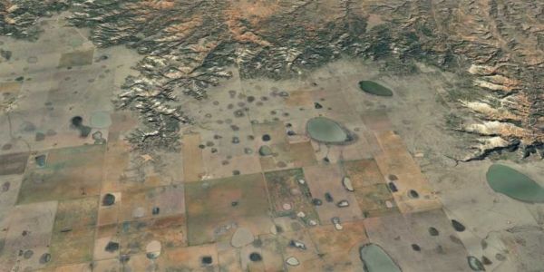
These plains provide vital habitat for millions of migratory birds and farmland essential to US agriculture. ETH geologist Sean Willett and his colleagues from the University of Nevada have been studying the origins of this extraordinary landscape.
Starting at the eastern foot of the Rocky Mountains in the midwest United States, the dramatic landscape of the High Plains stretches across several US states. Dropping just a few hundred meters over a length of more than 500 kilometres, these plains have only a very gentle gradient and the nearly flat surfaces exhibit unique ecosystems, making them a geological and ecological anomaly.
In the High Plains there are hundreds of thousands of small ephemeral lakes known as “playas”, that are filled with rainwater only during wet seasons, drying out completely during dry periods. The lakes provide an important breeding, resting and wintering habitat for millions of birds and also supply recharge to the groundwater reservoir known as the Ogallala aquifer. At 450,000 square kilometres, it is the largest aquifer in North America – and ten times the size of Switzerland. Without these groundwater resources, agriculture in this dry region would be nearly impossible.
Continue reading at ETH Zurich
Image via Google Earth / Land-sat / Copernicus, ETH Zurich


