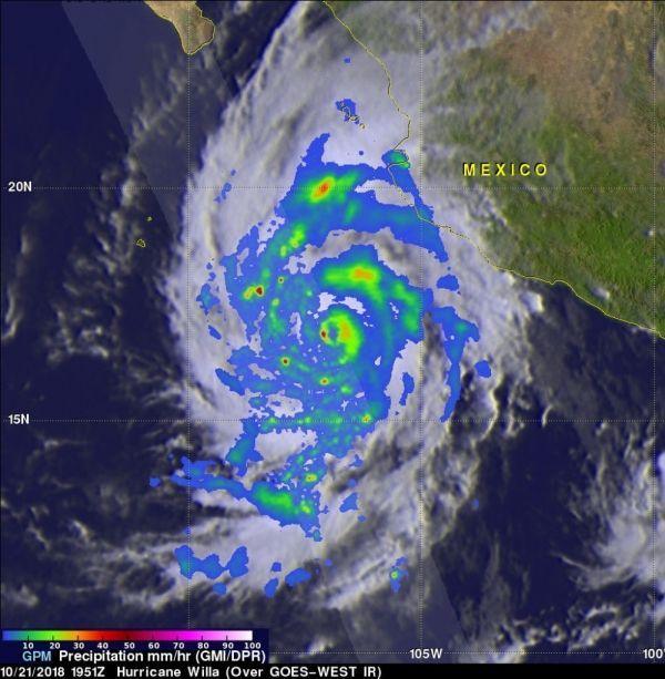
Hurricane Willa is a major hurricane threatening western Mexico. Forecasters were able to see the rate of rainfall occurring within the powerful storm when the Global Precipitation Measurement mission or GPM’s core satellite passed overhead and provided that data.
On Oct. 22, the National Hurricane Center or NHC noted that “Will became a potentially catastrophic category 5 hurricane on the Saffir-Simpson hurricane wind scale and is expected to produce life-threatening storm surge, wind, and rainfall over portions of west-central and southwestern Mexico.”
Willa’s Rapid History
Willa formed on Saturday, Oct. 20 and quickly became a tropical storm. By 5 p.m. EDT, Willa strengthened into a major hurricane and continued to strengthen.
Read more at NASA / Goddard Space Flight Center
Image: GPM passed above Willa on October 21, 2018 at 3:51 p.m. EDT (1951 UTC). The location of precipitation in Willa’s well defined eye wall was made evident by GPM’s radar (DPR Ku Band). DPR indicated that a few powerful convective storms within Willa were dropping rain at a rate of over 6.3 inches (160 mm) per hour. Credit: NASA / JAXA, Hal Pierce


