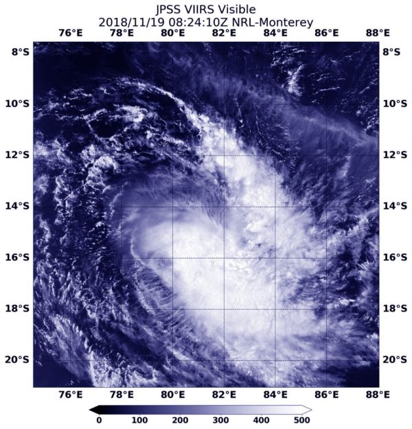
Tropical Cyclone 04S, known as Bouchra formed in the Southern Indian Ocean during the week of Nov. 12 and by the end of the week it had become a remnant low pressure area. Over the weekend of Nov. 17 and 18 it regenerated into a tropical cyclone and the NOAA-20 satellite passed overhead and captured a visible image of the storm.
At 3:24 a.m. EDT (0824 UTC) on Nov. 19the Visible Infrared Imaging Radiometer Suite (VIIRS) instrument aboard the NOAA-20 polar orbiting satellite saw the elongated storm. The VIIRS image revealed that the storm appeared to stretch from northwest to southeast. That’s an indication that winds or wind shear was affecting the storm and elongating its circulation center, weakening the storm (again).
Read more at NASA / Goddard Space Flight Center
Image: At 3:24 a.m. EDT (0824 UTC) on Nov. 19, the VIIRS instrument aboard NOAA’s NOAA-20 satellite captured a visible image of Tropical Cyclone Bouchra in the Southern Indian Ocean. CREDIT: NASA / NRL


