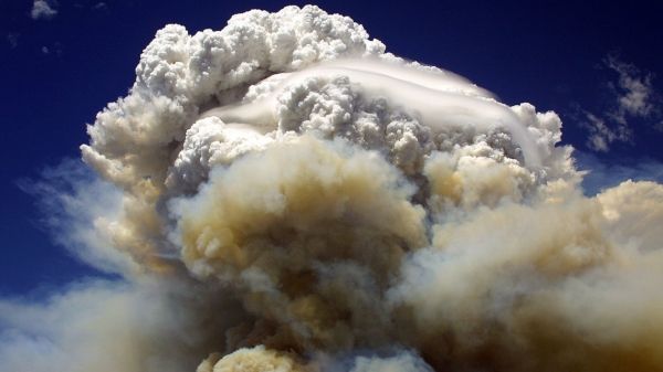
Early in the evening of August 12, 2017, heat and smoke from an intense wildfire burning in the forests of British Columbia began mushrooming skyward, sucking up ash, blazing wood and vegetation, and water vapor from lakes and streams below.
Rick McRae, a researcher with Australia’s Capital Territory Emergency Services Agency, was on site helping with fire management. Sensing that this conflagration was going to erupt into something extraordinary, he texted a group of scientists from around the world who since 2013 have been collaboratively studying fire-triggered thunderstorms — technically known as pyrocumulonimbus clouds, or “pyroCbs.”
“This is a very bad day all around in western Canada,” he wrote. “Fires went ‘pop’ progressively on the leading edge.” A pyroCb was forming in the southeast corner of British Columbia, near Kamloops, McRae added, noting, “Things could get worse if certain things ‘align.’”
And align they did. As fires that would eventually consume 4,700 square miles in British Columbia burned out of control, five fire-driven thunderstorms rose over the conflagration, shooting black smoke and carbon high into the lower stratosphere, spewing noxious gases that were eventually detected almost as far north as the North Pole, and touching off more fires. At the same time, fires in neighboring Washington State spawned yet another pyroCb. “By later that night we were agape about the cluster of pyroCbs and the extremely impressive smoky anvil-shaped clouds,” recalled Mike Fromm, a meteorologist at the U.S. Naval Research Laboratory.
Read more at Yale Environment 360
Image: A pyrocumulonimbus cloud forms over the Willow Fire near Payson, Arizona in July 2004. (Credit: ERIC NEITZEL / WIKIMEDIA COMMONS)


