Tropical Depression 02W has organized and strengthened into a tropical storm.
NASA-NOAA’s Suomi NPP satellite captured a visible image of the storm that showed bands of thunderstorms wrapping into a more organized center of circulation. 02W has been renamed Wutip.
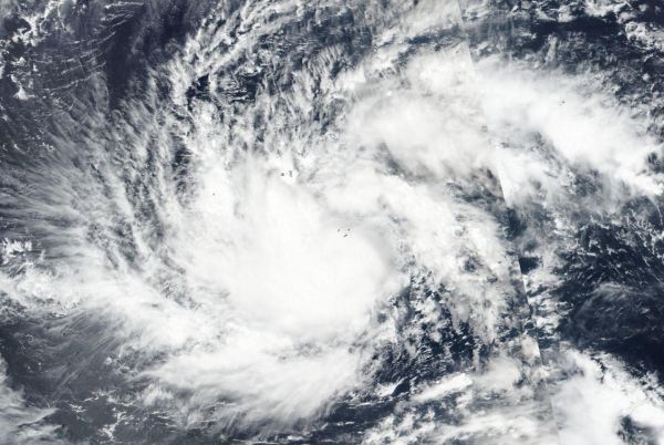
On Feb. 20, the Visible Infrared Imaging Radiometer Suite (VIIRS) instrument aboard NASA-NOAA’s Suomi NPP satellite provided a visible image of Tropical Cyclone Wutip. VIIRS revealed that bands of thunderstorms were wrapping into the low-level center of circulation.
Read more at NASA/Goddard Space Flight Center
Image: On Feb. 20, 2019, the VIIRS instrument aboard NASA-NOAA's Suomi NPP satellite captured a visible image of Tropical Cyclone Wutip in the Northwestern Pacific Ocean. (Credit: NASA Worldview, Earth Observing System Data and Information System (EOSDIS))