Maps that show where sharks and tunas roam in the eastern Pacific Ocean, and where fishing vessels travel in this vast expanse, could help ocean managers to identify regions of the high seas where vulnerable species may be at risk.
Researchers at Stanford University have created such a map by analyzing the habitats occupied by more than 800 sharks and tunas and 900 industrial fishing vessels. Focusing on international waters in the northeast Pacific, they found that vessels from Taiwan, China, Japan, the United States and Mexico accounted for over 90 percent of fishing in key habitat areas for seven shark and tuna species.
“The high seas are the global commons of the oceans,” said Timothy White, a graduate student in biology at Stanford and lead author of the paper detailing this research, published March 13 in Science Advances. “Analyses like this open the door to conversations about whether we think that the current mode of operation in the high seas is most equitable, most effective and most desirable.”
Read more at Stanford University
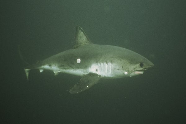
Image: By combining maps of habitats of marine predators, like this salmon shark, with satellite tracking of fishing fleets, researchers are identifying regions where they overlap. Credit: Scot Anderson, TOPP