Visible imagery from NASA’s Terra satellite showed Tropical Cyclone continued to move in a westerly direction after making landfall in Mozambique.
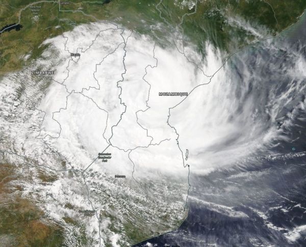
On March 15, the Moderate Resolution Imaging Spectroradiometer or MODIS instrument aboard NASA’s Terra satellite provided a visible image of Idai. The imagery showed the storm centered over central Mozambique and its western quadrant had already spread into Zimbabwe. Even over land, the system still showed a ragged eye on microwave satellite imagery.
At 0300 UTC on March 15 (11 p.m. EDT on March 14), the Joint Typhoon Warning Center or JTWC issued the final warning on Idai. At the time, Idai was over land and had maximum sustained winds near 90 knots (103.6 mph/166.7 kph). It was centered near 19.6 degrees north latitude and 34.8 degrees east longitude.
Read more at National Aeronautics and Space Administration
Photo: On March 15 the MODIS instrument aboard NASA’s Terra satellite provided a visible image of Tropical Cyclone Idai after it made landfall in Mozambique. CREDIT: NASA Worldview, Earth Observing System Data and Information System (EOSDIS)