Emerald Bay, California, a beautiful location on the southwestern shore of Lake Tahoe, is surrounded by rugged landscape, including rocky cliffs and remnants of mountain glaciers. Scenic as it may be, the area is also a complex structural puzzle. Understanding the history of fault movement in the Lake Tahoe basin is important to assessing earthquake hazards for regional policy planners.
The Lake Tahoe region is rife with active faults, many of which have created the dramatic and rugged landscapes. The Lake Tahoe region lies between the Sierra Nevada microplate to the west and the Basin and Range Province to the east. Northwestward movement of the Sierra Nevada microplate creates stresses that may produce both strike slip (horizontal) and vertical movement on faults. For years, geologists have traversed the forbidding terrain around Emerald Bay, noting where faults cut the landscape, but a detailed picture of the faults was still missing.
Two of these faults—the Tahoe-Sierra frontal fault zone (TSFFZ) and the West Tahoe-Dollar Point fault zone (WTDPFZ)—stretch along the western side of Lake Tahoe, but their continuity across landscapes and the nature of their movement has been debated for nearly two decades. Richard Schweickert, of the University of Nevada–Reno (UNR), part of a team of geologists and engineers from UNR, the U.S. Geological Survey, and Santa Clara University, said, “We found plenty of evidence for scarps (i.e., faults) that cut the glacial moraines all along the west side of Lake Tahoe, in particular around Emerald Bay.”
But it was what they couldn’t hike across that most interested them. “We were desperate to see what's actually going on the bottom [of Emerald Bay].” The research team decided to examine the faults both "by land and by sea".
Read more at Geological Society of America
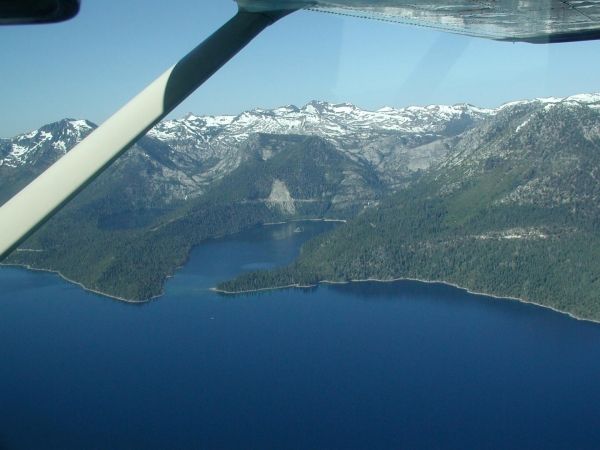
Image: This is Emerald Bay, Lake Tahoe, USA. (Credit: R.A. Schweickert et al.)