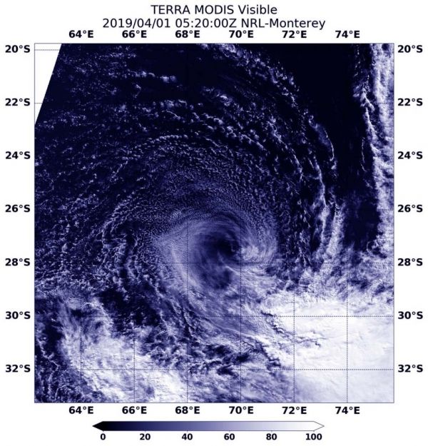
Visible imagery from NASA’s Terra satellite revealed that strong wind shear was adversely affecting Subtropical Cyclone Joaninha in the Southern Indian Ocean.
On April 1 at 1:20 a.m. EDT (0520 UTC), the Moderate Resolution Imaging Spectroradiometer or MODIS instrument aboard NASA’s Terra satellite provided a visible image of Subtropical Cyclone Joaninha. Joaninha transitioned into a subtropical storm over the weekend of March 30 and 31. Joaninha’s center was surrounded by a swirl of clouds around its center with most of its clouds and thunderstorms pushed southeast of center. Strong westerly to northwesterly vertical wind shear were tearing the storm apart.
Read more at NASA / Goddard Space Flight Center
Image: On April 1 at 1:20 a.m. EDT (0520 UTC), the MODIS instrument aboard NASA’s Terra satellite provided a visible image of Subtropical Cyclone Joaninha that showed the storm was being adversely affected by vertical wind shear. Credit: NASA/NRL


