It came as a surprise: A series of large waves rolled into New Jersey's Barnegat Inlet seven years ago, dragging a group of divers up and over a breakwater.
According to local news reportsoffsite link, the waves then crashed into a jetty where they knocked people into the water, causing injury and property damage.
Eyewitnesses reported seeing waves as high as 6 feet. But how? There had been no earthquakes or underwater landslides in the area.
NOAA scientists determined these waves were part of a meteotsunami, a small, weather-driven tsunami caused by changes in air pressure created by fast-moving severe thunderstorms, tropical storms, squalls or other storm fronts. The waves that hit New Jersey were generated from an intense, offshore squall line known as a derecho and were detected by more than 16 NOAA tide gauges along the East coast.
Read more at National Oceanic and Atmospheric Administration
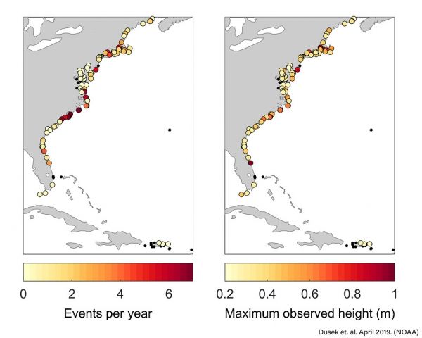
Image: NOAA scientists analyzed 22 years (1996-2017) of water level observations at 125 tide gauges along the East coast and found that on average 25 meteostunamis impact the East Coast each year. The figure on the left shows the average number of meteostunami events per year for each location, while the figure on right shows the maximum observed wave height for each meteotsunami event. The most impacted areas are the Carolinas and Long Island Sound. Small black dots indicate no events observed at those locations. (Citation for graphic: Dusek, G., C. DiVeglio, L. Licate, L. Heilman, K. Kirk, C. Paternostro, and A. Miller. 2019: A meteotsunami climatology along the U.S. East Coast. Bull. Amer. Meteor. Soc. doi:10.1175/BAMS-D-18-0206.1. In press.) (NOAA)


