As Tropical Storm Lorna continued moving in a southerly direction in the Southeastern Indian Ocean, NASA’s Aqua satellite passed overhead and provided forecasters with a look at the storm.
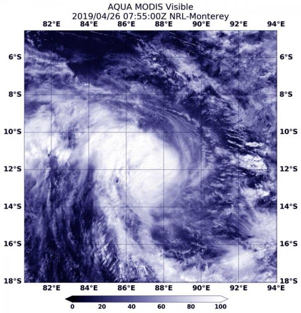
At 3:55 a.m. EDT (0755 UTC) on April 26, the Moderate Resolution Imaging Spectroradiometer or MODIS instrument aboard Aqua captured a visible image of Lorna. Lorna does not appear symmetrical and the strongest thunderstorms appear over the western side of the storm. The Joint Typhoon Warning Center or JTWC forecasters also noted, “Animated enhanced infrared satellite imagery depicts a central dense overcast feature obscuring the low-level circulation center.”
By 11 a.m. EDT (1500 UTC) on April 26, Tropical Storm Lorna had maximum sustained winds near 60 knots (46 mph/74 kph). Lorna was centered near 13.0 degrees south latitude and 88.6 degrees east longitude, approximately 495 nautical miles west of Cocos Island. Lorna was moving to the east-southeast.
Read more at NASA/Goddard Space Flight Center
Image: At 3:55 a.m. EDT (0755 UTC) on April 26, the MODIS instrument aboard Aqua captured a visible image of Tropical Storm Lorna in the Southeastern Indian Ocean. (Credit: NASA/NRL)