NASA-NOAA’s Suomi NPP satellite passed over the Southern Indian Ocean and captured a visible image of newly formed Tropical Cyclone Lili, located north of the coast of Australia’s Northern Territory.
The Australian Bureau of Meteorology or ABM issued a Strong Wind Warning for the following areas: Beagle Bonaparte Coast, North Tiwi Coast, Arafura Coast and Roper Groote Coast. There is no tropical cyclone warning currently in effect.
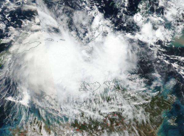
NASA-NOAA’s Suomi NPP satellite passed over Lili on May 9 and the Visible Infrared Imaging Radiometer Suite (VIIRS) instrument provided a visible image of the storm. The VIIRS image showed strong thunderstorms around the center of circulation and in a large band extending to the east of the storm. The satellite imagery shows a consolidating system in the Timor Sea.
Read more at NASA / Goddard Space Flight Center
Image: NASA-NOAA’s Suomi NPP satellite passed over the Southern Indian Ocean and captured a visible image of Tropical Cyclone Lili on May 9, as it continued to linger north of Australia’s Northern Territory. Credit: NASA Worldview, Earth Observing System Data and Information System (EOSDIS)/NOAA