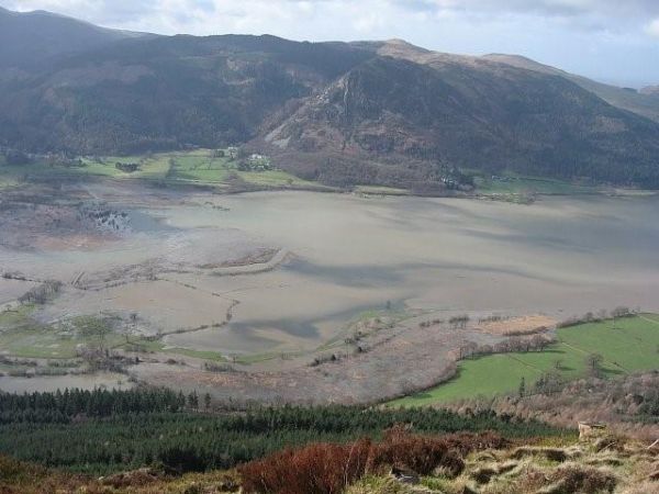
A new study of UK lake sediment records stretching back over several centuries has found that the floods that hit Northern England in 2009 and 2015 (‘Storm Desmond’) were the largest in 600 years, pointing to the impact of climate changes on the frequency and magnitude of these extreme events.
In a paper published in the journal `Earth Surface Processes and Landforms’, a team of researchers led by the Universities of Liverpool and Southampton, analysed the lake sediment records from the extreme floods of 2009 and 2015, and compared them with a 558 year record from the bottom of Bassenthwaite Lake, Cumbria.
A distinct layer of coarser sediment is left in the lake sediment record as material washes in from the surrounding hills and streams providing researchers with a means of recording each flooding event. Sediment layers with the largest grain sizes reflect flooding that was higher energy and more extreme in magnitude.
This is the first time a long term insight into the changing frequency and size of flood events has been produced using lake sediment records for the UK, and it shows how these archives can extend river flows used in conventional flood estimation, which only span relatively short period of 30-50 years.
Read more at University of Liverpool
Image: Bassenthwaite during Storm Desmond in 2015 (Credit: Jeff Warburton)


