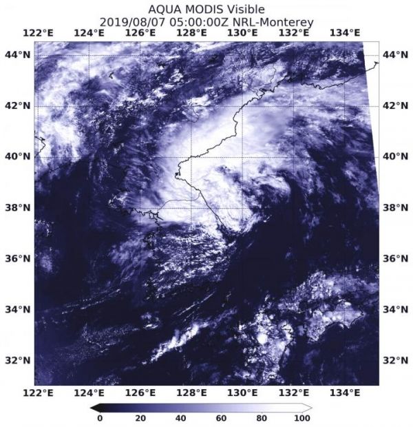
NASA’s Aqua satellite passed over the Sea of Japan and provided forecasters with a visible image of Tropical Storm Francisco as it was transitioning into an extra-tropical cyclone.
Often, a tropical cyclone will transform into an extra-tropical cyclone as it recurves toward the poles (north or south, depending on the hemisphere the storm is located in). An extra-tropical cyclone is a storm system that primarily gets its energy from the horizontal temperature contrasts that exist in the atmosphere. Extra-tropical cyclones (also known as mid-latitude or baroclinic storms) are low pressure systems with associated cold fronts, warm fronts, and occluded fronts.
Tropical cyclones, in contrast, typically have little to no temperature differences across the storm at the surface and their winds are derived from the release of energy due to cloud/rain formation from the warm moist air of the tropics. Structurally, tropical cyclones have their strongest winds near the earth’s surface, while extra-tropical cyclones have their strongest winds near the tropopause – about 8 miles (12 km) up.
Read more at: NASA/Goddard Space Flight Center
On Aug. 7, 2019 at 1:00 a.m. EDT (0500 UTC), the MODIS instrument aboard NASA's Aqua satellite provided a visible image of Tropical Storm Francisco in the Sea of Japan, along the Korean Peninsula. (Photo Credit: NASA/NRL)


