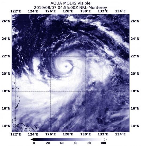
Lekima is now a typhoon and has triggered warnings in the Philippines. NASA’s Aqua satellite passed over the Northwestern Pacific Ocean and provided a visible image of the storm that shows a clear eye.
On Aug. 7, the Philippines’ PAGASA service issued Tropical cyclone warning signal #1 for the Luzon provinces of Batanes and Babuyan group of islands.
On Aug. 7, 2019 at 12:55 a.m. EDT (0455 UTC), the Moderate Resolution Imaging Spectroradiometer or MODIS instrument aboard NASA’s Aqua satellite provided a visible image of Lekima that revealed a clear eye surrounded by a tight, circular band of powerful thunderstorms. Lekima also has a large band of thunderstorms that are feeding into the center from the south and east.
Read more at NASA/Goddard Space Flight Center
Image: On Aug. 7, 2019 at 12:55 a.m. EDT (0455 UTC), the MODIS instrument aboard NASA's Aqua satellite provided a visible image of Typhoon Lekima in the Northwestern Pacific Ocean. (Credit: NASA/NRL)


