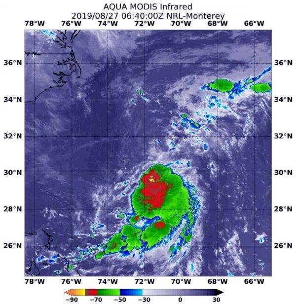
Newly formed Tropical Depression 6 in the Atlantic Ocean may have just formed, but it did so under adverse atmospheric conditions. The depression is battling wind shear and it’s apparent on imagery from NASA’s Aqua satellite.
Wind shear is a measure of how the speed and direction of winds change with altitude. When outside winds batter a tropical cyclone, it affects its circulation. A less circular storm tends to slow down in its spin and weaken.
Tropical Depression 6 or TD6 formed around 5 p.m. EDT on August 26 and has since been moving slowly while remaining a few hundred miles off the coast of the Carolinas.
Read more at: NASA/Goddard Space Flight Center
On August 27 at 2:40 a.m. EDT (0640 UTC) the MODIS instrument that flies aboard NASA's Aqua satellite showed a very small area of strongest storms (yellow) in Tropical Depression 6's center where cloud top temperatures were as cold as minus 80 degrees Fahrenheit (minus 62.2 Celsius). (Photo Credit: NASA/NRL)


