NASA’s Aqua satellite passed over the Eastern Pacific Ocean and provided an image of Hurricane Juliette as its eye began to emerge. Juliette has grown into a major hurricane, about 450 miles southwest of the southern tip of Baja California, Mexico.
Juliette developed on Sunday, Sept 1 around 5 a.m. EDT (0900 UTC) as a tropical storm. By 5 p.m. EDT on Sept. 2, the storm had strengthened into a hurricane.
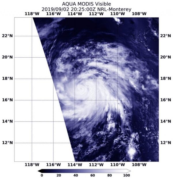
On Sept. 2, 2019 at 4:25 p.m. EDT (2025 UTC) the Moderate Resolution Imaging Spectroradiometer or MODIS instrument aboard NASA’s Aqua satellite provided a visible image of Hurricane Juliette that revealed its emerging eye around a thick tight circle of powerful thunderstorms. Hurricane-force winds extend outward up to 35 miles (55 km) from the center and tropical-storm-force winds extend outward up to 125 miles (205 km).
Read more at NASA / Goddard Space Flight Center
Image: On Sept. 2, 2019 at 4:25 p.m. EDT (2025 UTC) the MODIS instrument aboard NASA’s Aqua satellite provided a visible image of Hurricane Juliette in the Eastern Pacific Ocean as its eye began to show. Credit: NASA/NRL