While many NASA missions are tracking Hurricane Dorian as the storm makes its way toward the United States, some researchers are looking at what Dorian has already left behind.
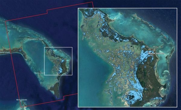
The Advanced Rapid Imaging and Analysis (ARIA) team at NASA's Jet Propulsion Laboratory in Pasadena, California, used synthetic aperture radar data from the European Space Agency's (ESA's) Copernicus Sentinel-1 satellites to produce this flood map of the Bahamas. The light blue color indicates areas that were likely flooded when the data were acquired on Sept. 2, 2019. In particular, the map shows flooding in and around Marsh Harbour in the Abaco Islands.
The map covers an area of about 109 miles by 106 miles (176 kilometers by 170 kilometers) shown by the large red polygon. Each pixel measures about 32 yards (30 meters) across. Authorities and responders can use flood maps like this one as guidance to identify areas that are likely experiencing flooding; the map may be less reliable over urban or vegetated areas.
Continue reading at NASA
Image via NASA/JPL-Caltech, ESA


