As Hurricane Dorian moves north in the Atlantic Ocean, brushing the nation’s Southeast coast with strong waves, winds, and rain, the USGS is providing comprehensive scientific capabilities and information that decision makers, emergency responders and communities can use to help them prepare, cope and recover from the storm.
This includes the USGS’ ability to forecast coastal change; track storm tides, river and stream levels and flow; measure coastal and inland flooding across entire regions; capture high-resolution ground elevation and topographic data; and create detailed maps used by disaster teams responding in the aftermath of storms.
Before a coastal storm is predicted to make landfall, the USGS begins collecting data that can improve forecasting, guide relief work, and speed up recovery from the powerful storms’ effects.
The Coastal Storm Response Team, a multidisciplinary group of specialists from throughout the USGS, works closely with the National Hurricane Center and other federal agencies and confers daily when forecasters indicate a hurricane or tropical storm is likely to make landfall in the U.S. The Storm Team closely follows the storm’s forecast intensity and track. Once a hurricane or tropical storm is considered likely to strike somewhere in the U.S., the team leaders decide whether it is necessary and safe to deploy USGS field crews to the storm’s projected path along the coast.
Continue reading at USGS.
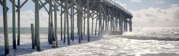
Image via USGS.