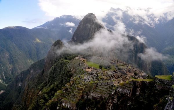
Phoenix, Arizona, USA: The ancient Incan sanctuary of Machu Picchu is considered one of humanity’s greatest architectural achievements. Built in a remote Andean setting atop a narrow ridge high above a precipitous river canyon, the site is renowned for its perfect integration with the spectacular landscape. But the sanctuary’s location has long puzzled scientists: Why did the Incas build their masterpiece in such an inaccessible place? Research suggests the answer may be related to the geological faults that lie beneath the site.
On Monday, 23 September 2019, at the GSA Annual meeting in Phoenix, Rualdo Menegat, a geologist at Brazil’s Federal University of Rio Grande do Sul, will present the results of a detailed geoarchaeological analysis that suggests the Incas intentionally built Machu Picchu—as well as some of their cities—in locations where tectonic faults meet. “Machu Pichu’s location is not a coincidence,” says Menegat. “It would be impossible to build such a site in the high mountains if the substrate was not fractured.”
Using a combination of satellite imagery and field measurements, Menegat mapped a dense web of intersecting fractures and faults beneath the UNESCO World Heritage Site. His analysis indicates these features vary widely in scale, from tiny fractures visible in individual stones to major, 175-kilometer-long lineaments that control the orientation of some of the region’s river valleys.
Read more at: Geological Society of America
Detailed mapping indicates the World Heritage Site's location and layout were dictated by the underlying geological faults. Photo taken 5 Nov. 2010. (Photo Credit: Rualdo Menegat)


