NASA-NOAA’s Suomi NPP satellite passed over Jerry and provided forecasters with a view of its structure that helped confirm it is now post-tropical.
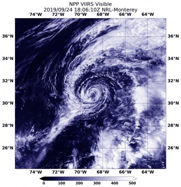
On Sept. 25 at 12:48 p.m. EDT (1806 UTC), the Visible Infrared Imaging Radiometer Suite (VIIRS) instrument aboard Suomi NPP provided a visible image Jerry. The VIIRS image showed the storm as swirls of clouds with no organized deep convection/developing strong thunderstorms. NOAA’s National Hurricane Center or NHC said since around 11 a.m. EDT (1500 UTC) yesterday [Sept. 24], that lack of strong thunderstorms was seen in earlier satellite imagery, including from NASA’s Aqua and Terra satellites. As a result, Jerry was designated as a post-tropical cyclone.
A Post-Tropical Storm is a generic term for a former tropical cyclone that no longer possesses sufficient tropical characteristics to be considered a tropical cyclone. Former tropical cyclones that have become fully extratropical, subtropical, or remnant lows, are three classes of post-tropical cyclones. In any case, they no longer possesses sufficient tropical characteristics to be considered a tropical cyclone. However, post-tropical cyclones can continue carrying heavy rains and high winds.
Read more at NASA/Goddard Space Flight Center
Image: On Sept. 24, 2019 at 2:06 p.m. EDT (1806 UTC) NASA-NOAA's Suomi NPP satellite passed over Post-Tropical Cyclone Jerry and it appeared as a swirl of clouds in the Atlantic Ocean. (Credit: NASA/NOAA/NRL)