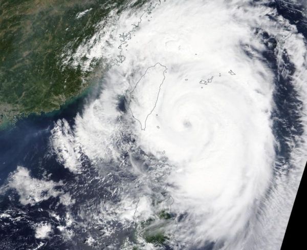
NASA’s Terra satellite captured an image of Typhoon Mitag’s cloud-filled eye, located east of Taiwan.
On Sept. 30, the Moderate Imaging Spectroradiometer or MODIS instrument that flies aboard NASA’s Terra satellite provided a visible image of Mitag. The MODIS image showed the cyclone continues to produce strong thunderstorms around its cloud-filled eye. Mitag’s western quadrant had already spread clouds and precipitation over Taiwan. Powerful bands of thunderstorms were swirling into the low-level center from the eastern side of the storm.
On Sept. 30, warnings remain in effect for the Philippines as Mitag, known locally as Onyok, continues to move north and away from the country. Philippines warnings still in effect include wind signal #1 for the Luzon provinces of Batanes and Babuyan Islands.
Read more at NASA / Goddard Space Flight Center
Image: On Sept. 30, the MODIS instrument that flies aboard NASA’s Terra satellite provided a visible image of Typhoon Mitag just east of Taiwan. Credit: NASA Worldview


