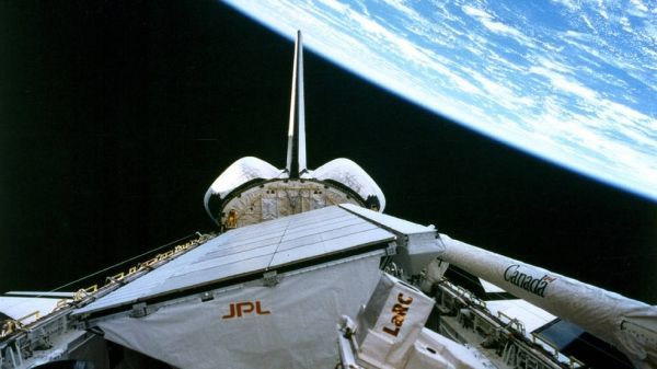
The Spaceborne Imaging Radar-C and X-Band Synthetic Aperture Radar (SIR-C/X-SAR) mission made available to people worldwide the scientific data used to this day to inform decisions to slow and mitigate climate change.
The SIR-C instrument, built by NASA'S Jet Propulsion Laborator in Pasadena, California, and the X-SAR instrument, built by the German Aerospace Center (DLR), constituted the most advanced imaging radar system ever used in air or space. During hundreds of orbits on two flights aboard the Space Shuttle Endeavour, in April and October 1994, the radar system made multiple passes over 19 "supersites" — areas of scientific interest in such locations as the Sahara, Brazil, the Alps and the Gulf Stream. It also imaged events occurring during the flights, such as as a volcano erupting in Russia.
"The many innovations of SIR-C/X-SAR have been used in virtually every air- and spaceborne radar mission since, starting with NASA's Shuttle Radar Topography Mission, which mapped 80% of the Earth in 2000," said Tony Freeman, now manager of JPL's Innovation Foundry, who led end-to-end calibration of SIR-C. "DLR's TerraSAR-X and TanDEM-X missions have since filled remaining gaps."
Radar imaging of Earth has never been the same since SIR-C/X-SAR's demonstration of what's known as simultaneous multifrequency, fully polarized, repeat-pass interferometric SAR. To unpack that sizable trunk of terminology, let's start with "synthetic aperture radar": Since the late 1970s, NASA has been imaging Earth with radar — in darkness, under cloud cover or vegetation, even underground — using the movements of a host airplane or spacecraft to "synthesize" an "aperture" much larger than the antenna itself. The larger the aperture, the greater the image resolution. Indeed, SIR-C's predecessors, SIR-A and SIR-B, were synthetic aperture radar missions.
Continue reading at NASA
Image via NASA


