Bushfire season in New South Wales, Australia, typically runs from October through March. Just one month into the 2019 season, news reports say the amount of burned area has already surpassed that of the past two years combined.
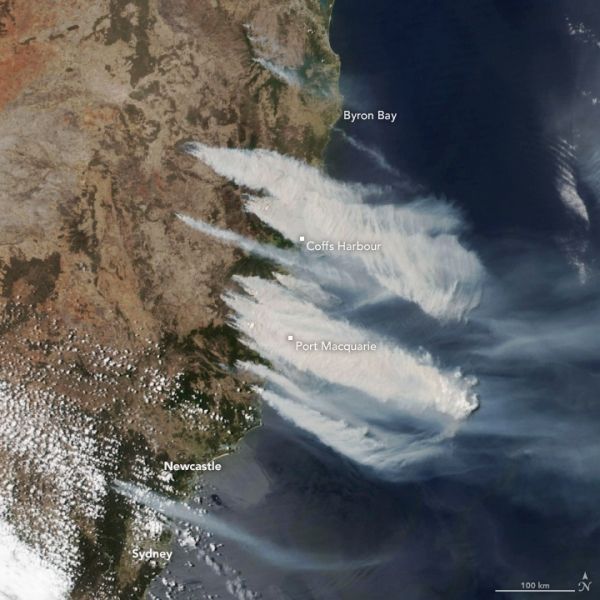
The recent spate of fires is visible in this image, acquired at 2:30 p.m. local time on November 8, 2019, by the Visible Infrared Imaging Radiometer Suite (VIIRS) on the NOAA-NASA Suomi NPP satellite. The fires burned near the coast from north of Sydney to the border with Queensland, with thick smoke blowing southeast over the Tasman Sea.
Three hours after this image was acquired, the New South Wales Rural Fire Service reported 96 fires burning across the state with 57 that remained uncontained. Seventeen were emergency-level fires—he highest alert level for a bushfire. According to news reports, that’s the highest number of emergency-level fires the state has seen burning at one time.
Continue reading at NASA Earth Observatory
Image via NASA Earth Observatory


