A network of brown squares contrasts starkly with the otherwise snow-white landscape of eastern North Dakota.
Daryl Ritchison, director of the North Dakota Agricultural Weather Network, noticed the phenomenon and posted an image on Twitter. He noted the brown squares have a simple explanation. “I’m 100 percent sure it is all corn,” Ritchison said. His certainty is based on estimates of yet-to-be harvested corn from the U.S. Department of Agriculture, combined with local knowledge of where corn is planted and comments from farmers.
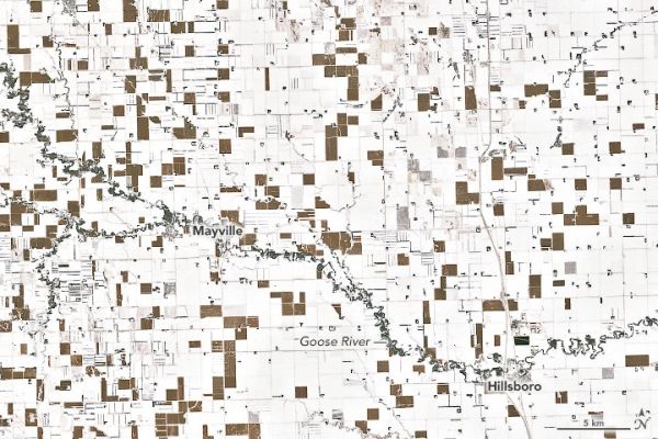
A detailed view of the corn and snow patchwork is shown above, as observed on December 3, 2019, with the Enhanced Thematic Mapper Plus (ETM+) on the Landsat 7 satellite.
The brown color of some patches doesn’t mean a lack of snow; about 6-10 inches of the white stuff is simply hidden from view. “The corn is planted at what is referenced as ‘row closure,’” Ritchison said. “Corn is touching corn, so the snow on the ground wouldn’t be visible from the air or satellite.”
Continue reading at NASA Earth Observatory
Image via NASA Earth Observatory