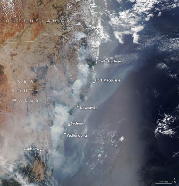
The fire season in New South Wales normally ramps up in December. In 2019, unusually hot weather and a potent drought primed the region for a roaring start in October. Two months later, more than 100 fires are still raging in forests and bush areas near the southeast coast, including some subtropical rainforests and eucalyptus forests that do not often see fire.
By December 12, 2019, fires in New South Wales had charred 27,000 square kilometers (10,000 square miles), an area about the size of Maryland. Vast plumes of smoke and pollution have streamed from fires for weeks, enveloping coastal towns and cities with toxic haze and smoke. Parts of Sydney, a city of 5 million people, recently endured pollution levels several times above what is considered hazardous, according to news reports.
The fires have been particularly damaging to eucalypt forests and woodlands, which thrive in areas of relatively dry and nutrient-poor soil. These forests are prone to big outbreaks of fire because many of the trees species have oil-rich foliage that is extremely flammable. The map above, based on data from Australia’s Department of Agriculture, shows the range of eucalypt forests. Red dots show the locations of fires as detected by the Visible Infrared Imaging Radiometer Suite (VIIRS) on the Suomi NPP satellite between November 1 and December 5, 2019.
Continue reading at NASA Earth Observatory
Image via NASA Earth Observatory


