Tropical Cyclone Calvinia formed on Dec. 29 and by the next day, its clouds from a band of thunderstorms on its western side had blanketed the island of Mauritius in the Southern Indian Ocean.
Calvinia’s center was just east of the island on Dec. 30. The storm has triggered a tropical cyclone warning class III in Mauritius.
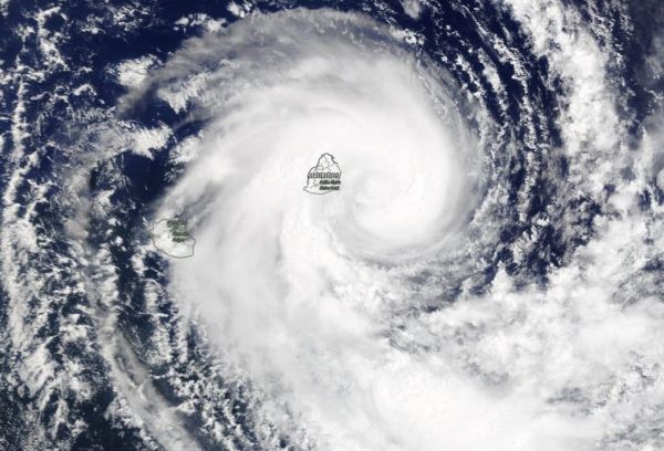
On Dec. 30, 2019, the Moderate Resolution Imaging Spectroradiometer or MODIS instrument that flies aboard NASA’s Terra satellite provided a visible image of Calvinia that showed the storm had a rounded shape. A rounded shape in a tropical cyclone indicates an organized storm. The MODIS image revealed bands of thunderstorms from the western side spiraled into the low-level center of circulation. That thick band of thunderstorms blanketed Mauritius bringing gusty winds and heavy rains.
On Dec. 30 at 0300 UTC (Dec. 29 at 10 p.m. EST) the Joint Typhoon Warning Center noted that Tropical Cyclone Calvinia was located near latitude 20.6 degrees south and longitude 58.8 degrees east, about 90 nautical miles east-southeast of Mauritius. Maximum sustained winds were 35 knots (40 mph). This storm is moving to the southwest.
Read more at NASA / Goddard Space Flight Center
Image: On Dec. 30, 2019, the MODIS instrument that flies aboard NASA’s Terra satellite provided a visible image of Tropical Storm Calvinia covering the island of Mauritius in the Southern Indian Ocean. Credit: NASA Worldview