For months, wildfires raging in Victoria, Queensland, and New South Wales have darkened skies in eastern Australia. In mid-January 2020, the skies turned a distinctive shade of orange for a different reason, as an enormous dust storm swept across the continent.
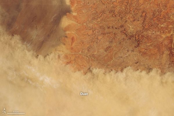
The Moderate Resolution Imaging Spectroradiometer (MODIS) on NASA’s Terra satellite captured a natural-color image (top) showing a front of thick dust stretching thousands of kilometers across Australia on January 11, 2020. The Operational Land Imager (OLI) on Landsat 8 acquired a higher-resolution image of the dust front in Queensland near Eromanga (below) about an hour earlier.
Strong winds associated with a passing low-pressure trough and storm system triggered the dust storm. Months of unusually dry weather have parched the soils, making it easier for winds to lift clay-sized (less than 4 micrometers), silt-sized (4 to 62.5 micrometers), and sand-sized (62.5 micrometers to 2 millimeters) dust particles high into the air.
Continue reading at NASA Earth Observatory
Image via NASA Earth Observatory