Afternoon storms are a typical phenomenon during summertime in Australia. They are a reminder that everyday natural events can be strikingly beautiful.
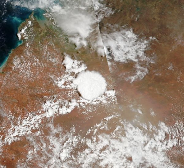
These images show the evolution of a storm over Western Australia on January 14, 2020. Morning skies appear clear in the left image, acquired around 11 a.m. local time. The storm starts growing in the afternoon at about 1 p.m. (middle) and even larger an hour later (right image). The natural-color images were acquired (from left to right) with the Moderate Resolution Imaging Spectroradiometer (MODIS) on NASA’s Terra satellite; MODIS on NASA’s Aqua satellite, and the Visible Infrared Imaging Radiometer Suite (VIIRS) on the NOAA-NASA Suomi NPP satellite.
According to Bastiaan Van Diedenhoven, a researcher for Columbia University and NASA’s Goddard Institute for Space Studies, the cloud is a cumulonimbus—a type capable of producing thunderstorms and heavy rain.
“Afternoon storms form often in the Austral summer as the land heats up, leading the air to rise and condense into clouds,” Van Diedenhoven said. “The storm looks very round from the top probably because there’s not much wind shear. When the top reaches its highest point near the tropopause, its top will expand horizontally.”
Continue reading at NASA Earth Observatory
Image via NASA Earth Observatory