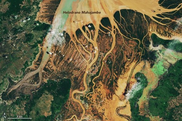
Torrential rains from several tropical disturbances soaked Madagascar in late January 2020, causing widespread and deadly flooding in the northern reaches of the island. Floods and landslides were reported in the Alaotra Mangoro, Analamanga, Betsiboka, Boeny, Melaky, and Sofia regions, with news and relief agencies reporting at least 30 lives lost and more than 15,000 homes destroyed or flooded. On January 24, the government of the island nation (population 25 million) declared a state of emergency and made appeals for international assistance.
On January 27, 2020, the Operational Land Imager (OLI) on Landsat 8 captured natural-color images of sediment-filled rivers swollen out of their banks and pouring their outflow into Helodrano Mahajambe (Mahajambe Bay) in northwestern Madagascar. For comparison, the second image in each pair shows the same area under more typical seasonal conditions on January 18, 2017.
According to Accuweather, the town of Mahajanga reported 358 millimeters (14.09 inches) of rain from January 19-25, and 592 mm (23.29 inches) for the month of January. Normal rainfall is 292 mm (11.50 inches) for the month. To the north and east (not shown), Arrachart received 192 mm (7.55 inches) from January 19-25 and 495 mm (19.50 inches) throughout January (normal is 159 mm/6.25 inches).
Continue reading at NASA Earth Observatory
Image via NASA Earth Observatory


