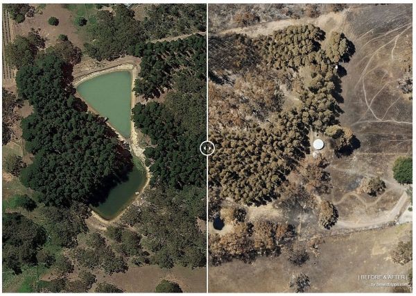
The maps, which contain unprecedented detail and are available from the Airborne Research Australia (ARA) website, are intended to assist communities, emergency services agencies and researchers to plan recovery from SA’s summer infernos, to better understand fire behaviour and develop future fire defence strategies.
ARA collects data for these high-resolution maps from low, slow flights by crewed motorgliders equipped with LIDAR, hyperspectral sensors and high-resolution RGB cameras. *
It renders this mapping data in three dimensions (3D) and animates it as flythroughs to simplify viewing.
“In many cases, remote sensing data taken from fire-affected areas disappears into a black hole, so the general public either never sees it or sees only a down-sampled low-resolution version,” he says.
Continue reading at Flinders University
Image via Flinders University