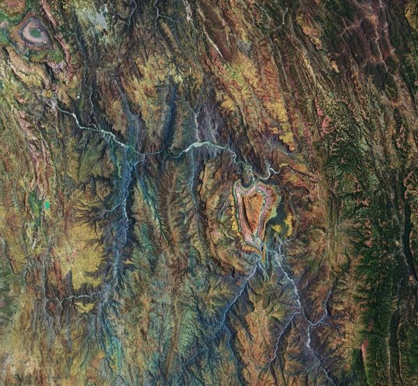
The highlands are part of the Altiplano, meaning High Plateau, a region that stretches almost 1000 km from Peru to Bolivia. The landscape consists of a series of basins lying about 3500 m above sea level and is the most extensive area of high plateau on Earth, outside Tibet.
This particular area featured here is a transition between the desert in the west and the tropical forest in the east. The heart-shaped formation has been moulded by many layers of different geological formations over time. The many streams and rivers visible in this image have also contributed to the shaping of the landscape as we see it today.
This false-colour composite image was processed by selecting spectral bands that can be used for classifying geological features – but here the image processing also highlights this lovely heart for today’s image.
Continue reading at European Space Agency
Image via European Space Agency