When explorer Marco Polo passed through modern-day Myanmar (Burma) about 700 years ago, one city caught his attention: Bagan. Known as Pagan at the time, it was the capital of the Pagan Kingdom. This first Burmese empire lasted from the 9th to 13th centuries and had heavy Buddhist influences. Around 10,000 temples and religious structures were built in the capital in that era, and Polo was captivated by the numerous spires that dotted the landscape, saying the towers made the city “one of the finest sights in the world.”
In the middle of the 13th century, the Pagan Kingdom collapsed due to invasions by the Mongols. Many of the city’s temples and pagodas crumbled from the repeated attacks as well as natural disasters (mostly earthquakes). Yet more than 3,000 historic buildings and ruins still stand today, making Bagan one of the most impressive archeological sites in Asia.
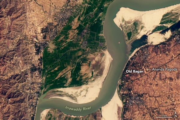
The satellite images above show the Bagan Archeological Zone on February 6, 2020. The zone includes four main settlements: Old Bagan, New Bagan, Myinkaba, and Nyaung U. The ancient temples, pagodas, and other religious structures are mainly located within 26 square kilometers (16 square miles) of Old Bagan. The natural-color images were acquired by the Operational Land Imager (OLI) on the Landsat 8 satellite. The photograph below shows temples rising above the landscape in Old Bagan.
Continue reading at NASA Earth Observatory
Image via NASA Earth Observatory


