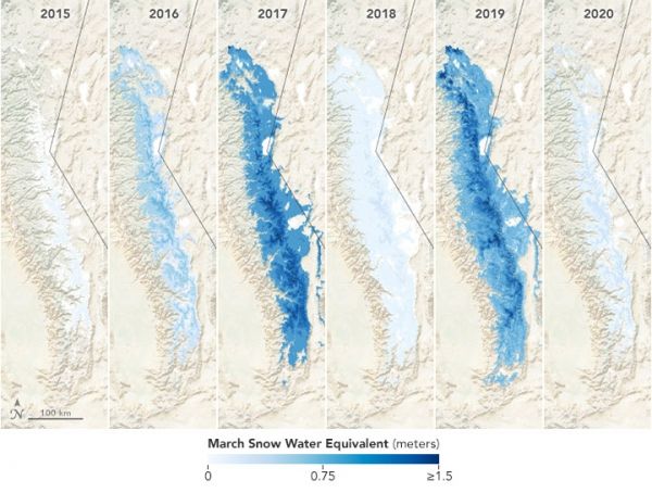
The winter of 2019-2020 brought a range of extreme weather to the mid-latitudes of the Northern Hemisphere, with some areas receiving a deluge of moisture and others staying much drier than usual. California experienced the latter, as evidenced by the thin snowpack in the Sierra Nevada near the start of spring.
The natural-color satellite images above, acquired by the Moderate Resolution Imaging Spectroradiometer (MODIS) instruments on NASA’s Terra and Aqua satellites, show the area covered by snow in March 2020 compared to March 2017 (a record high year).
Snow-covered areas make for an interesting visual, but such imagery does not tell a complete story because it does not account for the depth or density of the snow. A more meaningful indicator of the quality of the snowpack is snow-water equivalent—an estimate of how much water you would get if all of the snow melted at once.
Continue reading at NASA Earth Observatory
Image via NASA Earth Observatory


