The island has been scarred by volcanic eruptions, livestock grazing, penal colonies, and bombs. In late February 2020, it was scarred by fire. Yet there is hope for healing on the small Hawaiian island of Kaho’olawe.
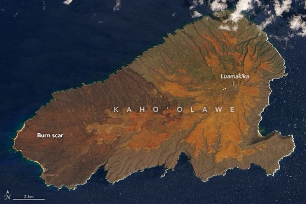
The smallest of Hawaii’s eight main islands, Kaho’olawe sits about 7 miles (11 kilometers) southwest of Maui. The island is relatively dry for the tropics (no more than 26 inches/65 centimeters of rainfall annually) because of its location in the rain shadow of Haleakala volcano. While there are some coastal cliffs on the southern and eastern ends of Kaho’olawe, the island cuts a relatively low profile, mostly below 500 feet (150 meters) in elevation. Luamakika crater on Pu’u Moaulanui is the highest point, rising 1,477 feet (450 meters) above sea level.
On February 22, 2020, wildfire broke out along the western edge of the island. Over the course of a week, more than 9,000 acres (about one-third of the island) of scrubby, grassy land were consumed by the blaze, which was eventually extinguished by rain and firefighters from Maui. The Operational Land Imager (OLI) on Landsat 8 acquired these natural-color images of Kaho’olawe before and after the fire, on February 20 and March 7, 2020. Note the dark brown burn scar along the western end. To the east, much of the island has an orange-red tone due to bare hardpan dirt—a result of erosion and dry weather.
Continue reading at NASA Earth Observatory
Image via NASA Earth Observatory