Recent years have brought unusually large and damaging wildfires to the Pacific Northwest – from the Carlton Complex Fire in 2014 that was the largest in Washington’s history, to the 2017 fire season in Oregon, to the 2018 Maple Fire, when normally sodden rainforests on the Olympic Peninsula were ablaze. Many people have wondered what this means for our region’s future.
A University of Washington study, published this winter in Fire Ecology, takes a big-picture look at what climate change could mean for wildfires in the Northwest, considering Washington, Oregon, Idaho and western Montana.
“We can’t predict the exact location of wildfires, because we don’t know where ignitions will occur. But based on historical and contemporary fire records, we know some forests are much more likely to burn frequently, and models can help us determine where climate change will likely increase the frequency of fire,” said lead author Jessica Halofsky, a research scientist at the UW School of Environmental and Forest Sciences and with the U.S. Forest Service.
The review was done in response to a survey of stakeholder needs by the Northwest Climate Adaptation Science Center, a UW-hosted federal–university partnership. State, federal and tribal resource managers wanted more information on the available science about fire and climate change.
Read more at University of Washington
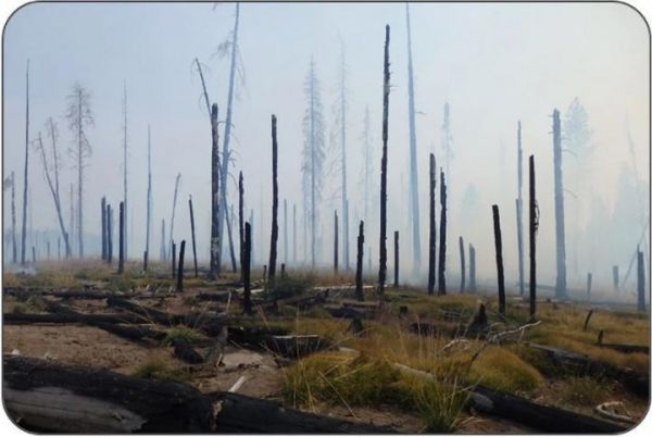
Image: This land in southwest Washington's Gifford Pinchot National Forest has burned three times since 2008: the Cold Springs fire in 2008, the Cascade Creek fire in 2012 and the Cougar Creek fire in 2015. (Credit: Darryl Lloyd)


